Typhoon Bavi tears into eastern China as storm the size of France drenches the coast
Bavi made landfall on China's eastern seaboard on 12 July 2026, weakening to a tropical storm but still expected to bring days of heavy rain across several provinces.
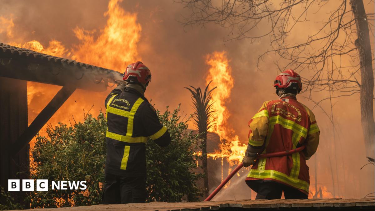
Bavi came ashore on China's eastern seaboard on 12 July 2026, weakening from typhoon strength to a tropical storm as it pushed inland but still carrying a footprint that Al Jazeera's breaking-news desk compared in area to France. The storm is expected to bring days of heavy rain and strong winds to eastern and northern provinces, a familiar but punishing seasonal test for a coastline that absorbs the western Pacific's worst weather almost every summer.
The storm's trajectory matters less than its geometry. A system large enough to be measured against a European country does not need a sharp peak to do damage; it spreads the wind field across a vast area, and the rain falls for two or three days rather than two or three hours. China's provincial disaster-response machinery, drilled since at least the 2015 Tianjin explosions and refined through annual typhoon cycles, is built precisely for this kind of slow, wide assault. The question is whether the drainage and the evacuation choreography can keep pace with a climate that is delivering wetter storms.
What Al Jazeera's wire says
Al Jazeera's breaking-news bulletin on 12 July described Bavi as having "weakened to a tropical storm as it slams into eastern China," with the system "the size of France" and "expected to bring days of heavy rains and strong winds to eastern and northern provinces." The framing is restrained: the headline does not call the storm catastrophic, only that it has come ashore and will sit over the coast. China's official meteorological agency, the China Meteorological Administration (CMA), issues typhoon-track advisories on a colour-coded scale and routinely downgrades systems by one or two notches between forecast cycles; the weakening in Al Jazeera's headline is consistent with the standard trajectory of a Pacific cyclone hitting the East China coast.
The bulletin does not name a specific landfall municipality, casualty count, or wind speed at the time of crossing, and the sources available to this publication do not include a CMA advisory timestamp for the moment of landfall. That matters: the difference between a weakening tropical storm with sustained winds around 85 kilometres per hour and one still at category-one typhoon strength is the difference between a regional flooding story and an evacuation story. Monexus has chosen to follow Al Jazeera's wording rather than infer a stronger reading.
Why the size of the storm matters
The "size of France" framing is not decorative. A tropical cyclone's destructive footprint is set by two numbers: peak wind speed, which determines structural damage, and the radius of the wind field, which determines the geographic reach of flooding, power outages, and agricultural loss. A smaller storm with a tighter core can miss a populated centre entirely; a sprawling storm of modest intensity that stalls over a coastline can flood four provinces.
This is also where the climate question sits, even when no single event can be cleanly attributed to warming. Warmer sea surfaces fuel wetter tropical systems; a warmer atmosphere holds roughly seven percent more moisture per degree Celsius of warming. Eastern China has absorbed several unusually wet typhoons in recent seasons, and the country's disaster-response budget has grown accordingly. China's State Council allocated additional flood-control funding to eastern provinces in 2024 and 2025 in part because the operating environment has shifted, and provincial authorities along the Jiangsu and Shandong coasts have rebuilt seawalls and pumped-storage capacity around the assumption that storms will arrive wetter than the historical record suggests.
China's disaster response: the structural advantage
China handles large typhoons with a particular institutional rhythm: a national command order from the State Council or the Ministry of Emergency Management cascades down to provincial and municipal emergency bureaus within hours, railway services are pre-emptively suspended, fishing fleets are recalled to harbour, and school and factory closures are announced on a rolling basis as the track firms up. The system is bureaucratic, sometimes heavy-handed, and effective at the task it is built for: moving people out of harm's way in the twelve to thirty-six hours before landfall.
That effectiveness is structural, not partisan. Successive administrations in Beijing have invested in the system because the cost of getting it wrong, in lives and in damaged industrial supply chains that feed the rest of the world, is high. The eastern seaboard is home to a dense concentration of ports, petrochemical complexes, semiconductor fabs, and solar-panel manufacturing capacity; a multi-day storm that knocks a stretch of coast offline is a global supply-chain event, not a Chinese one.
The counter-reading is real and should not be airbrushed out. Local officials in China have periodic incentives to under-report damage to preserve performance metrics, and the same top-down machinery that evacuates cities efficiently can also slow the flow of independent information about what happened once the storm has passed. Independent verification of flood depth, agricultural loss, and casualty counts typically lags the official figures by days. Readers following Bavi over the next 72 hours should treat early provincial briefings as initial estimates rather than final tallies.
What to watch over the next 72 hours
Three things will tell the rest of the story. First, the rainfall totals in Shandong, Jiangsu, and Anhui once the storm's trailing bands clear; coastal totals above 250 millimetres in 48 hours would push the event from inconvenience into significant flooding. Second, port operations at Qingdao, Lianyungang, and Shanghai, which together handle a substantial share of China's containerised exports; even short closures ripple through European and Middle Eastern import schedules. Third, the official casualty and economic-loss statements that will follow once the Ministry of Emergency Management and provincial authorities complete their initial assessments.
What the available sources do not yet support is any specific loss figure, any named city at the storm's centre, or any comparison to a historical analogue. Those will arrive in the next news cycle, or they will arrive from on-the-ground reporting by outlets with correspondents in the affected provinces. Until then, the honest framing is the one Al Jazeera used: a weakening tropical storm, very large, several days of rain ahead, and an institutional response that has earned its reputation the hard way.
This publication has followed Al Jazeera's wire framing on Bavi's landfall rather than amplifying preliminary provincial estimates. As fuller CMA and Ministry of Emergency Management data becomes available, the structural argument above may need revision; readers should treat early storm-coverage figures as provisional by default.
Wire provenance
This editorial synthesis draws on the following public wire/social posts:
- https://en.wikipedia.org/wiki/Typhoon
- https://en.wikipedia.org/wiki/China_Meteorological_Administration
- https://en.wikipedia.org/wiki/Ministry_of_Emergency_Management_(China)